Features MetarMap
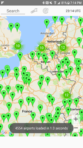
MetarMap illustrates the visibility conditions using Metars from airports all around the world.
Airports marker colors indicate the current visibility.
This presentation helps users to have a good understanding of current visibility in a region or a particular airport.
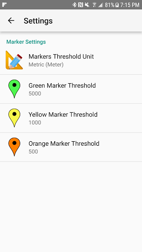
MetarMap settings allow you to change the color thresholds to customize it for your needs based on the metric (meters) and US (statute miles) units.
When an airport is selected the most recent Metar and TAF are displayed.
Finally, MetarMap allows you to easily search for an airport using its ICAO code.
Gaming Features
Enjoy immersive gaming experience with various game modes.
24/7 Support
Our dedicated support team is always ready to help you.
Personalization
Customize the app to match your preferences and workflow.
See the MetarMap in Action
Get the App Today
Available for Android 8.0 and above